![]()
|
|
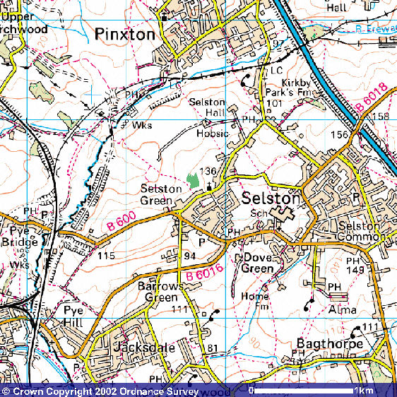
How To Find Us Directions (Satnav Postcode: NG16 6EX) Selston may be located on a road map of Nottinghamshire as being close to the line of the M1 motorway, approximately mid-way between Junctions 27 and 28. If approaching on the motorway, either of these junctions may be used - from the South exit at Junction 27, follow the A608 towards Heanor and after ¾ mile turn right and right again on to the B600, signposted Selston - from the North, exit at Junction 28, selecting the B6019 exit at the island and soon afterwards turn left, proceeding through Pinxton to Selston. Selston itself lies on the B600 Nottingham to Alfreton road, approximately 12 miles from Nottingham and 4 miles from Alfreton. St Helen's church is located on Church Lane, which runs from the B600 near where it leaves the village to the North (the last possible right turn before leaving the village in the direction of Alfreton). The approach from the other end of Church Lane may be used as the first right turn off the road from Pinxton. St Helen's is clearly signposted from either end of Church Lane. Note that the church in the neighbouring village of Pinxton is also dedicated to St Helen! The church tower is visible from most directions of approach, except that from Pinxton. Alternatively it is located on the map below by the green arrow:
Image produced from the Ordnance Survey Get-a-map service. Image reproduced with kind permission of Ordnance Survey and Ordnance Survey of Northern Ireland.
|
|
|